 Interwest’s GIS Team
 created an
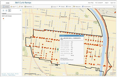
ArcGIS Online application that was used in the field to collect individual curb ramp location attribute information. The goal of the project was to create an improvement plan for the
City of Bell to repair curb ramps over several fiscal years depending on priority. The plan was used to help the city with its Americans with Disabilities Act (ADA) Compliance efforts.
The GIS team met with City of Bell staff to determine a list of attributes required for the project, created a shell geodatabase with these attributes in ArcGIS Server to facilitate direct live edits into the city production data set, and brought the geodatabases together with aerial photos provided by
Esri’s Bing Basemaps. The GIS team systematically reviewed the entire city, creating a point location for each curb ramp, then created an ArcGIS Online application to be used in the field for data collection.

A field inspector visited each location and updated the condition of the curb ramps using ArcGIS Online on a 3G enabled Apple iPad. These updates were available in real time to GIS staff at the office.
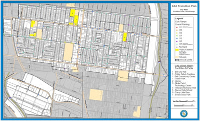
After the data collection phase was complete, the GIS team worked with project engineers to determine location priorities such as high traffic areas and physical condition of the curb ramp. After all the priorities were determined a Map Series was made to display these priorities and create an improvement plan across several fiscal years.
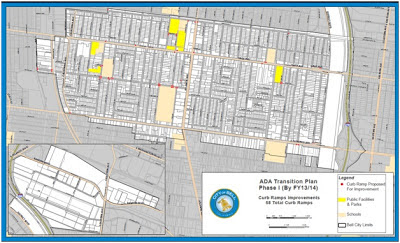
The data was brought into ArcMap to create maps for a public meeting to showcase the city's plans for future ramp improvements. An ADA Transition plan was created for each fiscal year; additional maps were created to show the public the plans for the current year.
Contact us today to find out how
Interwest Consulting Group's
GIS Team can help your public agency use GIS in your ADA Compliance efforts.


 Interwest’s GIS Team created an ArcGIS Online application that was used in the field to collect individual curb ramp location attribute information. The goal of the project was to create an improvement plan for the City of Bell to repair curb ramps over several fiscal years depending on priority. The plan was used to help the city with its Americans with Disabilities Act (ADA) Compliance efforts.
 After the data collection phase was complete, the GIS team worked with project engineers to determine location priorities such as high traffic areas and physical condition of the curb ramp. After all the priorities were determined a Map Series was made to display these priorities and create an improvement plan across several fiscal years.


