
The City required mailing labels for the following:
1. Owners: A query layer was used to combine the two parcel layers into one Owners layer: one for parcels inside the city and one for parcels within a half mile of the city boundary.
2. Occupants: A query layer was used to join the point layer of occupants with the parcel layer to create one parcel layer allowing all occupants of a single parcel to be selected when the parcel is selected.
3. Neighborhood Groups
Interwest utilized Esri's Web AppBuilder to create the application in the City's ArcGIS Online Account.
The users can search for the APN, Situs Address, or Neighborhood Group name.

The search locates and selects the parcel:

The Situation Awareness widget was utilized to provide the buffer and export. Initial the buffer, input the # of feet to buffer around the parcel and the buffer will draw on the map.
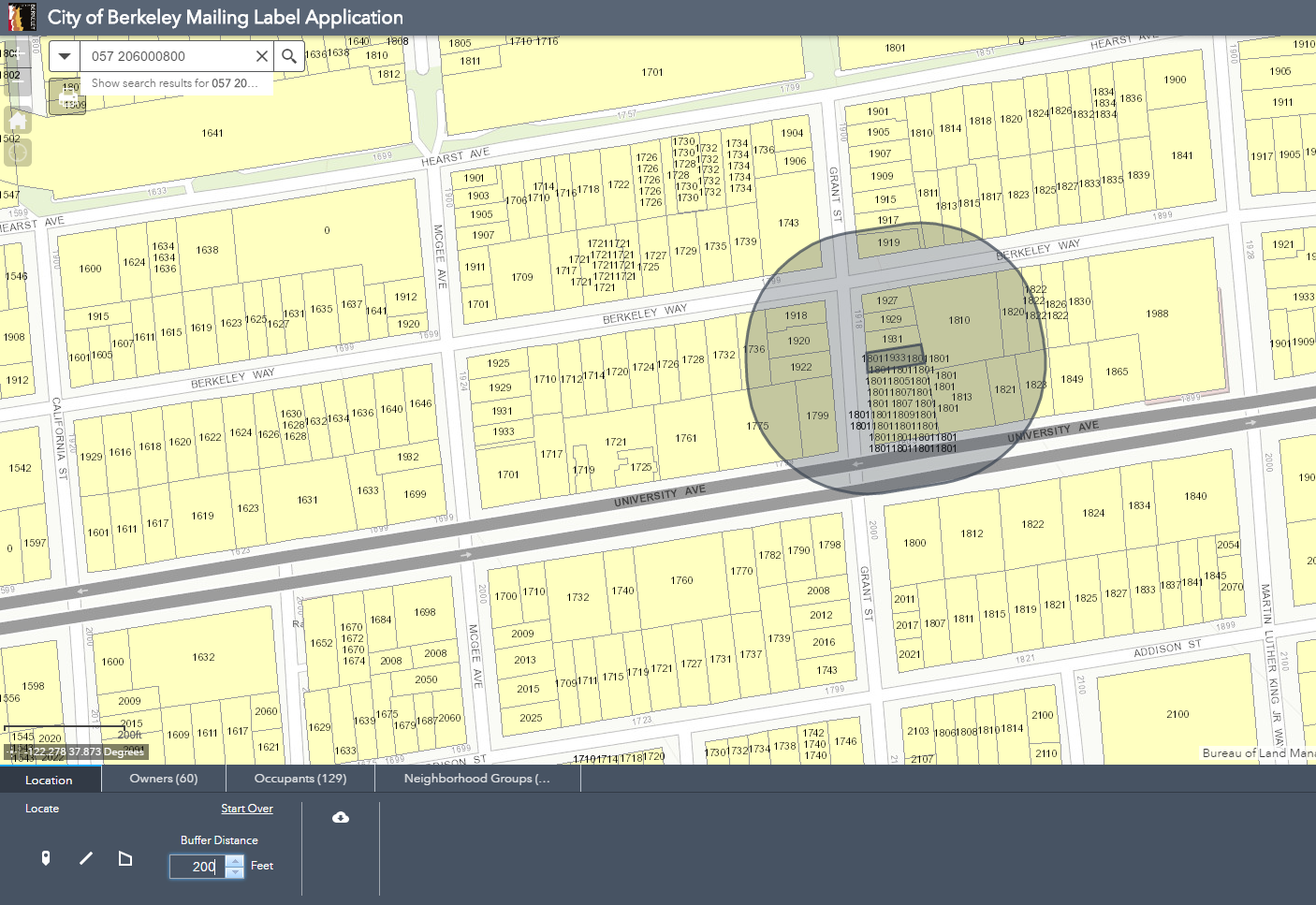
Click the Owner, Occupants, or Neighborhood Groups tabs to view the selected parcels and download the csv file.

The tool can also be used to drop a point, draw a line, or draw a polygon to select the owners, occupants, and neighborhood groups.

Need assistance creating a mailing label application for your agency? Connect with us at: http://www.interwestgrp.com/serv-gis.php
No comments:
Post a Comment
Note: Only a member of this blog may post a comment.